Record Detail
Large format version available - click on Zoom button to browse this image in a zoomable viewer
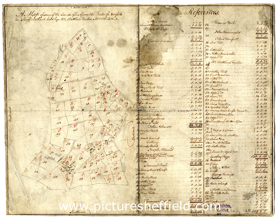
| arc02661 | |
| A map of some of the lands of his Grace the Duke of Norfolk in Sheffield Park held by Mr Matthew Fenton, Mrs White, etc., post 1788 | |
| Sheffield_Manor_Park | |
| 1500-1799 | |
No scale. Surveyor: [William Fairbank II]. Land bounded by Cricket Inn Road, Manor Lane, Manor Park Crescent, Dovercourt Road and Park Hill Lane [Park Hall Lane] Fields numbered and listed with particulars. Owners initials added in red. Shows Manor House ruins. B, p. 60. Dimensions: 35 x 27.5 cm. Original at Sheffield City Archives: ACM/MAPS/SheD/735S. Digitised with financial support from Sheffield and District Family History Society in memory of Professor David Hey (1938-2016) founder and life president of the Society. |
Copying and access
This digital image, and all images on Picture Sheffield, are protected by copyright. You may use it for private study or non-commercial research, with due acknowledgement.
You may share it on social media via a linked post or by citing www.picturesheffield.com together with the Image Reference, unless its copyright is noted as belonging to another organisation. You must not reproduce it by any other means without permission.