Record Detail
Move cursor over image to magnify
| u02619 | |
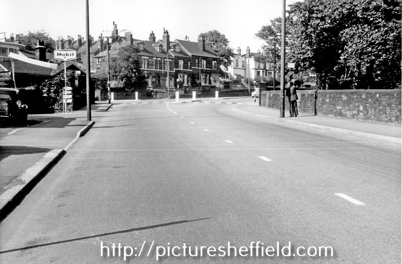
| Burngreave Road looking towards the junction with Pitsmoor Road and Barnsley Road with the old Toll Bar House visible after the garage, Kingdom Hall (centre), Tower Ballroom (white building) and Abbeyfield Park on the right | |
| Sheffield_Burngreave | |
| 02/08/1961 | |
| 1960-1979 | |
| City Engineers and Surveyors Department | |
| SCC | |
Burngreave Road ends at the site of the old Toll Bar. Continuing into Barnsley Road towards Firs Hill: Left hand side of of the road (behind the wall) is the old road and is Pitsmoor Road, from Shirecliffe Lane to Orphanage Road.; the right hand side from Abbeyfield Park is Barnsley Road. Row of housing etc is 521-529 Pitsmoor Road The Tower Ballroom (white building with the tower now removed) formerly Dey's Dancing Academy later became the Mojo Club in 1964 Kingdom Hall sign shows (centre left) |
Copying and access
This digital image, and all images on Picture Sheffield, are protected by copyright. You may use it for private study or non-commercial research, with due acknowledgement.
You may share it on social media via a linked post or by citing www.picturesheffield.com together with the Image Reference, unless its copyright is noted as belonging to another organisation. You must not reproduce it by any other means without permission.