Record Detail
Large format version available - click on Zoom button to browse this image in a zoomable viewer
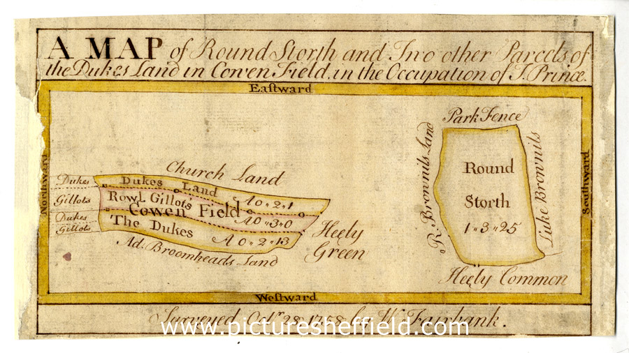
| arc02737 | |
| Map of Round Storth and two other parcels of the Duke of Norfolk's land in Lowen Field, in the occupation of T. Prince | |
| Sheffield_Heeley | |
| 1758 | |
| 1500-1799 | |
Scale [3 chains : 1 inch] [26.6 inches : 1 mile] Surveyor: William Fairbank I. Several strips on the north [or west?] side of Heeley Green and a close between Heeley Common and the Park Fence; to the north of Gleadless Road between Upper Heeley and Newfield Green. Colours distinguish ownership; Field names and acreages given on the map; mear stones marked; yellow border. C, p. 61. Dimensions: 21 x 11.5 cm. Original at Sheffield City Archives: ACM/MAPS/SheD/870S. Digitised with financial support from Sheffield and District Family History Society in memory of Professor David Hey (1938-2016) founder and life president of the Society. |
Copying and access
This digital image, and all images on Picture Sheffield, are protected by copyright. You may use it for private study or non-commercial research, with due acknowledgement.
You may share it on social media via a linked post or by citing www.picturesheffield.com together with the Image Reference, unless its copyright is noted as belonging to another organisation. You must not reproduce it by any other means without permission.