Search Results
Found 9419 records
| No | Image | Details | Add to Album |
|---|---|---|---|
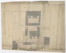
| 1 | ![William Hoyle’s land between Meadow Street and St Philip’s Road, [1846] William Hoyle’s land between Meadow Street and St Philip’s Road, [1846]](https://www.picturesheffield.com/imagefiles/jpgs_sheffield3//arc04163.jpg) | arc04163 William Hoyle’s land between Meadow Street and St Philip’s Road, [1846] | |
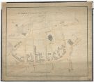
| 2 |  | arc04164 Plan of George Vickers property in Meadow Street, Edward Street and Allen Street | |
| 3 | ![Properties in Mill Sands and Nursery Street, [1806] Properties in Mill Sands and Nursery Street, [1806]](https://www.picturesheffield.com/imagefiles/jpgs_sheffield3//arc04167.jpg) | arc04167 Properties in Mill Sands and Nursery Street, [1806] | |
| 4 |  | arc04168 Moorfields. Plan of the ground between Green Lane and Gibraltar | |
| 5 | ![Norfolk Row. Land between Far Gate [Fargate] and Norfolk Street adjoining the Catholic Chapel Norfolk Row. Land between Far Gate [Fargate] and Norfolk Street adjoining the Catholic Chapel](https://www.picturesheffield.com/imagefiles/jpgs_sheffield3//arc04170.jpg) | arc04170 Norfolk Row. Land between Far Gate [Fargate] and Norfolk Street adjoining the Catholic Chapel | |
| 6 | ![Moorfields. Measures of Eyre and Hallam’s land, and other tenements, taken for T Holy, [1816-1817] Moorfields. Measures of Eyre and Hallam’s land, and other tenements, taken for T Holy, [1816-1817]](https://www.picturesheffield.com/imagefiles/jpgs_sheffield3//arc04169.jpg) | arc04169 Moorfields. Measures of Eyre and Hallam’s land, and other tenements, taken for T Holy, [1816-1817] | |
| 7 | ![Property between Norfolk Street and Sycamore Street, occupied by Benjamin Damms, John Barber and George Dalton, [1828] Property between Norfolk Street and Sycamore Street, occupied by Benjamin Damms, John Barber and George Dalton, [1828]](https://www.picturesheffield.com/imagefiles/jpgs_sheffield3//arc04173.jpg) | arc04173 Property between Norfolk Street and Sycamore Street, occupied by Benjamin Damms, John Barber and George Dalton, [1828] | |
| 8 |  | arc04174 Plan of certain premises situate between Norfolk Street and Sycamore Street late the property of Thomas Calverley, deceased | |
| 9 | ![Plan of premises in Norfolk Street the property of George Rodgers [?Joseph Rodgers and Sons] Plan of premises in Norfolk Street the property of George Rodgers [?Joseph Rodgers and Sons]](https://www.picturesheffield.com/imagefiles/jpgs_sheffield3//arc04175.jpg) | arc04175 Plan of premises in Norfolk Street the property of George Rodgers [?Joseph Rodgers and Sons] | |
| 10 |  | arc04176 Plan of Joseph Fenton and William Butcher's premises in Pinstone Lane and Norfolk Street |
Found 9419 records.