Record Detail
Large format version available - click on Zoom button to browse this image in a zoomable viewer
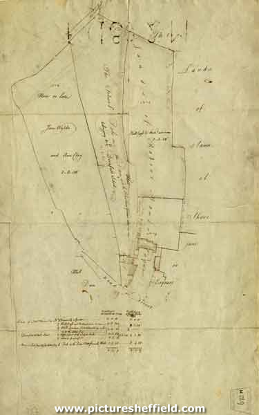
| arc01822 | |
| Map of portions of land of - Non or late Jane Wylde and Ann Clay, Dronfield School land, lands of Robert Mower Esquire | |
| Derbyshire_Dronfield | |
| 1792 | |
| 1500-1799 | |
Gives details of acreage surveyed by W. Fairbank, [18th cent] and Joseph Parker in 1792. Also gives adjacent land as Samuel Shore Junioe Esquire and Mill Dam. Scale not given. Dimensions 52 x 34 cm. Original at Sheffield City Archives: BM/672. |
Copying and access
This digital image, and all images on Picture Sheffield, are protected by copyright. You may use it for private study or non-commercial research, with due acknowledgement.
You may share it on social media via a linked post or by citing www.picturesheffield.com together with the Image Reference, unless its copyright is noted as belonging to another organisation. You must not reproduce it by any other means without permission.