Record Detail
Large format version available - click on Zoom button to browse this image in a zoomable viewer
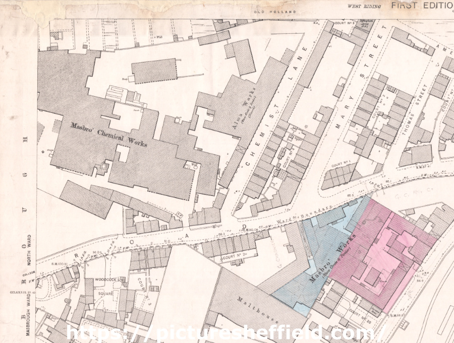
| q00016 | |
| Ordnance Survey Map, sheet no. Yorkshire 289.11.6 (north west) | |
| Rotherham | |
| 1889 | |
| 1851-1899 | |
Top left: Masbrough Chemical Works, Chemist Lane, College Road, Mary Street, [William Hall] Alma Works, Amen Corner, Thomas Street, Effingham Arms (Public House), Masbrough Works, Malthouse, Woodcock's Square, Masbrough Street. Scale 10.56 feet : 1 mile [1:500]. Original at Sheffield City Archives. |
Copying and access
This digital image, and all images on Picture Sheffield, are protected by copyright. You may use it for private study or non-commercial research, with due acknowledgement.
You may share it on social media via a linked post or by citing www.picturesheffield.com together with the Image Reference, unless its copyright is noted as belonging to another organisation. You must not reproduce it by any other means without permission.