Place the cursor on an image to see its title. Click to enlarge and obtain more information.
Click on add to album to keep a working record of the images you are interested in |
Place the cursor on an image to see its title. Click to enlarge and obtain more information.
Click on add to album to keep a working record of the images you are interested in |
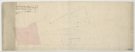
![View: arc03994 Plan of estates at Rand Moor [Ranmoor] and Nether Green in the township of Upper Hallam the property of John Eyre](https://www.picturesheffield.com/imagefiles/jpgs_sheffield3//arc03994.jpg)
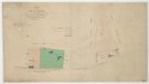
![View: arc03995 Owlerton Hall estate. The property of Lady Burgoyne [1825]](https://www.picturesheffield.com/imagefiles/jpgs_sheffield3//arc03995.jpg)
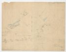
![View: arc03996 Owlerton. Lady Burgoynes' land - White House, High House, Hill Foot, Limerick Wheel, [1825]](https://www.picturesheffield.com/imagefiles/jpgs_sheffield3//arc03996.jpg)
![View: arc03998 Bradfield Road Owlerton Wheel, [1834]](https://www.picturesheffield.com/imagefiles/jpgs_sheffield3//arc03998.jpg)
![View: arc03999 Plan relating to an agreement between Thomas Bower and the Limerick Wheel Company for an exchange, [1819]](https://www.picturesheffield.com/imagefiles/jpgs_sheffield3//arc03999.jpg)
![View: arc04001 A plan of Joseph Clay’s farm and contiguous lands of the Earl of Surrey. Adjacent to Clay Wood, [1781]](https://www.picturesheffield.com/imagefiles/jpgs_sheffield3//arc04001.jpg)
![View: arc04003 St James's Row. Endorsed, the new Park Cricket Ground measured for William Wright, Charles Hazlehurst and Jacob Bridge, [1825]](https://www.picturesheffield.com/imagefiles/jpgs_sheffield3//arc04003.jpg)
;)
;)
;)
;)
;)
;)
;)
;)
;)
;)