Place the cursor on an image to see its title. Click to enlarge and obtain more information.
Click on add to album to keep a working record of the images you are interested in |
Place the cursor on an image to see its title. Click to enlarge and obtain more information.
Click on add to album to keep a working record of the images you are interested in |
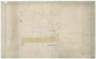
![View: arc04236 Intended line of St Philip's Road (where it enters Broad Lane) between the property of John Woodhouse and Francis Petit, [1829]](https://www.picturesheffield.com/imagefiles/jpgs_sheffield3//arc04236.jpg)
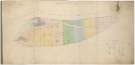
![View: arc04238 St Philip's Road. David Doncaster’s land at Port Mahon, in lots, [1828 - 1829]](https://www.picturesheffield.com/imagefiles/jpgs_sheffield3//arc04238.jpg)

![View: arc04240 A map of Hall Car Farm, Royds Mill Farm and sundry other contiguous lands of the Earl of Surrey, with alterations [Savile Street], [1779, 1781]](https://www.picturesheffield.com/imagefiles/jpgs_sheffield3//arc04240.jpg)
![View: arc04242 Scotland Street. Freehold and leasehold property of JW Birks valued for sale for Wilson and Younge, [1827]](https://www.picturesheffield.com/imagefiles/jpgs_sheffield3//arc04242.jpg)
![View: arc04243 The Earl of Surrey's land, including land between Whitehouse Lane and the Dunn, [Shalesmoor], [1784]](https://www.picturesheffield.com/imagefiles/jpgs_sheffield3//arc04243.jpg)
![View: arc04244 Plan of the land situate at Moorfields purchased by Joseph Read of the Duke of Norfolk [Shalesmoor] [1826]](https://www.picturesheffield.com/imagefiles/jpgs_sheffield3//arc04244.jpg)
![View: arc04245 Joseph Read's property at Shalesmoor, [1826]](https://www.picturesheffield.com/imagefiles/jpgs_sheffield3//arc04245.jpg)
;)
;)
;)
;)
;)
;)
;)
;)
;)
;)