Search Results
Found 20225 records
| No | Image | Details | Add to Album |
|---|---|---|---|
| 1 |  | y18018 Plan of the area adjacent to the Markets and Sheffield Canal Basin | |
| 2 |  | y18020 Sheffield Sewerage: Plan Shewing Drainage Districts and Main Sewers | |
| 3 |  | y18024 Sheffield, a new plan of Sheffield reduced from the Ordnance Survey and comprises all the subsequent improvements, new streets etc from 1850 to 1873 | |
| 4 |  | y18034 Sheffield, a new plan of Sheffield reduced from the Ordnance Survey and comprises all the subsequent improvements, new streets etc from 1850 to 1873 | |
| 5 |  | y18035 Charles Hooper and Co. Ltd's Map of Sheffield | |
| 6 |  | y18049 Ordnance Survey of Yorkshire 1890-96: Attercliffe and part of Darnall | |
| 7 | 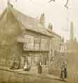 | t17653 Old Queen's Head public house (formerly the Hall in the Ponds), No. 40 Pond Hill | |
| 8 | 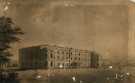 | ov00138 Sheffield General Infirmary (latterly Sheffield Royal Infirmary), Infirmary Road, Sheffield | |
| 9 |  | arc04270 Broomspring Lane, Sheffield - land at Spring Field measured for John Hoyland, [1828] | |
| 10 |  | arc04271 Samuel Shore's large allotment at Fulwood Lane, divided into parts held by Benjamin Fox, Samuel Halgate and Samuel Green, [1828] |
Found 20225 records.