Search Results
Found 17997 records
| No | Image | Details | Add to Album |
|---|---|---|---|
| 1 | 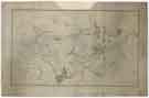 | arc04580 Map of the parish of Sheffield by W. Fairbank & Son (engraved by J. Cary) | |
| 2 | ![The new Rail Road from the Colliery described and annexed to the Plan of Sheffield by the same scale, [c. 1776]](https://www.picturesheffield.com/imagefiles/jpgs_sheffield3//arc04579.jpg "The new Rail Road from the Colliery described and annexed to the Plan of Sheffield by the same scale, [c. 1776]") | arc04579 The new Rail Road from the Colliery described and annexed to the Plan of Sheffield by the same scale, [c. 1776] | |
| 3 | ![Plan showing the parish boundaries of Bradfield Chapelry, Hallam, Ecclesfield, Loxley Common, Wadsley and Sheffield Park, all within the Manor of Sheffield, [1777]](https://www.picturesheffield.com/imagefiles/jpgs_sheffield3//arc04578.jpg "Plan showing the parish boundaries of Bradfield Chapelry, Hallam, Ecclesfield, Loxley Common, Wadsley and Sheffield Park, all within the Manor of Sheffield, [1777]") | arc04578 Plan showing the parish boundaries of Bradfield Chapelry, Hallam, Ecclesfield, Loxley Common, Wadsley and Sheffield Park, all within the Manor of Sheffield, [1777] | |
| 4 |  | arc04584 An exact copy of Smithson Dawson's map of the Township of Roundhay in the parish of Barwick in the West Riding of the County of York, belonging to the Duke of Norfolk, surveyed in the year 1774 | |
| 5 | 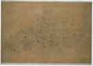 | arc04589 A map of the Manor of Rotherham in the West Riding of the County of York, Surveyed for the Right Honourable Thomas Earl of Effingham | |
| 6 | 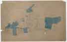 | arc04590 A map of the Manor of Rotherham in the West Riding of the County of York, Surveyed for the Right Honourable Thomas Earl of Effingham | |
| 7 | 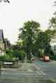 | v04691 Montgomery Road, Nether Edge |
Found 17997 records.