Search Results
Found 16854 records
| No | Image | Details | Add to Album |
|---|---|---|---|
| 1 | 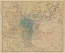 | y18035 Charles Hooper and Co. Ltd's Map of Sheffield | |
| 2 |  | y18049 Ordnance Survey of Yorkshire 1890-96: Attercliffe and part of Darnall | |
| 3 | 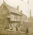 | t17653 Old Queen's Head public house (formerly the Hall in the Ponds), No. 40 Pond Hill | |
| 4 | 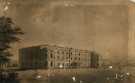 | ov00138 Sheffield General Infirmary (latterly Sheffield Royal Infirmary), Infirmary Road, Sheffield | |
| 5 |  | arc04416 Corn Exchange - plan of cellars | |
| 6 |  | y15497 Card issued by R. Waterhouse, wholesale confectioner, West Bar for distribution with funeral biscuits | |
| 7 |  | arc04465 Plan of an estate near Wadsley Bridge in the parish of Ecclesfield belonging to the Duke of Norfolk in the occupation of Mrs Holt and others | |
| 8 |  | arc04466 Beeley Wood Lane / Limestone Hall Lane: proposed railway line [Manchester, Sheffield and Lincolnshire Railway] | |
| 9 |  | arc04467 Plan of the west side of Birley Edge Road | |
| 10 |  | arc04468 Oughtibridge Hall and lands to the Don |
Found 16854 records.