Search Results
Found 7090 records
| No | Image | Details | Add to Album |
|---|---|---|---|
| 1 | ![Tracing made from the plans attached to the Sheffield Award dated 25 Sep 1805, [after 1828]](https://www.picturesheffield.com/imagefiles/jpgs_sheffield3//arc04582.jpg "Tracing made from the plans attached to the Sheffield Award dated 25 Sep 1805, [after 1828]") | arc04582 Tracing made from the plans attached to the Sheffield Award dated 25 Sep 1805, [after 1828] | |
| 2 | ![Tracing made from the plans attached to the Sheffield Award dated 25 Sep 1805, [after 1828]](https://www.picturesheffield.com/imagefiles/jpgs_sheffield3//arc04581.jpg "Tracing made from the plans attached to the Sheffield Award dated 25 Sep 1805, [after 1828]") | arc04581 Tracing made from the plans attached to the Sheffield Award dated 25 Sep 1805, [after 1828] | |
| 3 |  | arc04577 Plan of the Duke of Norfolk's estate in the Township of Brightside Bierlow in the Parish of Sheffield | |
| 4 |  | arc04585 A map of the County of Nottingham (north-west) | |
| 5 |  | arc04586 A map of the County of Nottingham (north-east) | |
| 6 |  | arc04588 A map of the County of Nottingham (south-west) | |
| 7 |  | arc04591 A plan of Gallowtree Hill Field, White Cross Field and Hammer Acre in which the several Allotments, and the original Properties of which they consist, and their several quantities, are marked (Rotherham / Treeton) | |
| 8 | 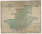 | arc04593 A map of the Estate in the Township of Kimberworth belonging to Samuel Kirk | |
| 9 | ![East view of Sheffield in 1745 [from Park Hill], from the original sketch by Samuel Buck](https://www.picturesheffield.com/imagefiles/jpgs_sheffield3//u13900.jpg "East view of Sheffield in 1745 [from Park Hill], from the original sketch by Samuel Buck") | u13900 East view of Sheffield in 1745 [from Park Hill], from the original sketch by Samuel Buck | |
| 10 | 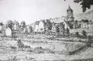 | w02952 Backfields |
Found 7090 records.