Search Results
Found 2791 records
| No | Image | Details | Add to Album |
|---|---|---|---|
| 1 |  | y18013 Sketch plan used to illustrate The Replanning of Sheffield by R D Bennett. Map No 2 Pond Street area | |
| 2 |  | y15986 Mount Tabor United Free Methodist Chapel, junction of Wellington Street / Rockingham Street | |
| 3 |  | y18014 Sketch plan used to illustrate The Replanning of Sheffield by R D Bennett. Map No 3 Pond Street area | |
| 4 |  | y18015 Sketch plan used to illustrate The Replanning of Sheffield by R D Bennett. Map No 4 Milton Street area | |
| 5 |  | y18016 Sketch plan used to illustrate The Replanning of Sheffield by R D Bennett. Map No 5 Milton Street area | |
| 6 |  | y18017 Sketch plan used to illustrate The Replanning of Sheffield by R D Bennett. Map No 6 Arundel Street area - 'suggested works-flats' | |
| 7 |  | y18019 Geographia plan of Sheffield, [1937] | |
| 8 |  | y18021 Plan of Sheffield | |
| 9 | 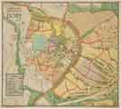 | y18044 Proposed development, Dore, Sheffield, [c. 1930s?] | |
| 10 | 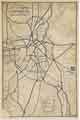 | y18045 City of Sheffield central road proposals, [c. 1924] |
Found 2791 records.