Search Results
Found 1160 records
| No | Image | Details | Add to Album |
|---|---|---|---|
| 1 | 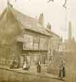 | t17653 Old Queen's Head public house (formerly the Hall in the Ponds), No. 40 Pond Hill | |
| 2 |  | y18010 Borough of Sheffield, Moorhead Improvement Scheme as proposed by Councillor George Skinner | |
| 3 | 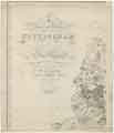 | arc04585 A map of the County of Nottingham (north-west) | |
| 4 | 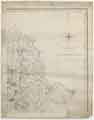 | arc04586 A map of the County of Nottingham (north-east) | |
| 5 |  | arc04587 A map of the County of Nottingham (south-east) | |
| 6 |  | arc04588 A map of the County of Nottingham (south-west) | |
| 7 |  | arc04591 A plan of Gallowtree Hill Field, White Cross Field and Hammer Acre in which the several Allotments, and the original Properties of which they consist, and their several quantities, are marked (Rotherham / Treeton) | |
| 8 |  | arc04593 A map of the Estate in the Township of Kimberworth belonging to Samuel Kirk | |
| 9 |  | arc04597 Map of Attercliffe, [c. 1815 - 1849] | |
| 10 |  | arc04600 Plan of building lots on Park Hill, extending from the Canal Basin to Shrewsbury Street, and east to Park Hill Lane, c. 1800 |
Found 1160 records.