Search Results
Found 123694 records
| No | Image | Details | Add to Album |
|---|---|---|---|
| 1 | 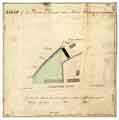 | arc02714 Map of two parcels of ground near to the Morton Wheel | |
| 2 | ![Map of certain lands near Upperthorp [Upperthorpe] belonging to the Duke of Norfolk, usually annexed to Slack House Farm, but now under lease to John Senior](https://www.picturesheffield.com/imagefiles/jpgs_sheffield2//arc02715.jpg "Map of certain lands near Upperthorp [Upperthorpe] belonging to the Duke of Norfolk, usually annexed to Slack House Farm, but now under lease to John Senior") | arc02715 Map of certain lands near Upperthorp [Upperthorpe] belonging to the Duke of Norfolk, usually annexed to Slack House Farm, but now under lease to John Senior | |
| 3 | ![Plan of the Ground on Crooks Moor [Crookesmoor] proposed to be taken by Whittington Sowter of the Duke of Norfolk](https://www.picturesheffield.com/imagefiles/jpgs_sheffield2//arc02718.jpg "Plan of the Ground on Crooks Moor [Crookesmoor] proposed to be taken by Whittington Sowter of the Duke of Norfolk") | arc02718 Plan of the Ground on Crooks Moor [Crookesmoor] proposed to be taken by Whittington Sowter of the Duke of Norfolk | |
| 4 | 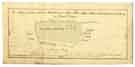 | arc02721 Map of a close called the Doles near Tapton Hill in Upper Hallam held of the Earl of Surrey by Joseph Badger | |
| 5 | 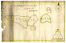 | arc02722 Survey of Bellhag Farm | |
| 6 | 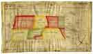 | arc02723 Map of Crimicar Lane Estate in the Township of Upper Hallam | |
| 7 | 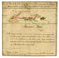 | arc02724 Plan of the Snuff Mill, Cutler's Wheel, adjoining the Dam etc at Sharrow Moor, occupied by Joseph Wilson and Edwd. Anderton | |
| 8 | ![Eye Draft of land purchased of Thomas Sambourne in the Township of Upper Hallam, [post 1795]](https://www.picturesheffield.com/imagefiles/jpgs_sheffield2//arc02725.jpg "Eye Draft of land purchased of Thomas Sambourne in the Township of Upper Hallam, [post 1795]") | arc02725 Eye Draft of land purchased of Thomas Sambourne in the Township of Upper Hallam, [post 1795] | |
| 9 | 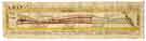 | arc02726 Map of several intermixed parcels of land at Heeley, the property of the Duke of Norfolk and S. Shore, esquire | |
| 10 | ![Plan of a Close near Healey [Heeley] belonging to the Duke of Norfolk taken for the use of the Turnpike Road, [c. 1750-1759]](https://www.picturesheffield.com/imagefiles/jpgs_sheffield2//arc02727.jpg "Plan of a Close near Healey [Heeley] belonging to the Duke of Norfolk taken for the use of the Turnpike Road, [c. 1750-1759]") | arc02727 Plan of a Close near Healey [Heeley] belonging to the Duke of Norfolk taken for the use of the Turnpike Road, [c. 1750-1759] |
Found 123694 records.