Search Results
Found 123694 records
| No | Image | Details | Add to Album |
|---|---|---|---|
| 1 | 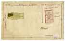 | arc03325 A plan of sundry building lots near the bottom of Park Hill | |
| 2 | ![A Plan of several building lots on Park Hill [Duke Street], c. 1778-1800](https://www.picturesheffield.com/imagefiles/jpgs_sheffield2//arc03326.jpg "A Plan of several building lots on Park Hill [Duke Street], c. 1778-1800") | arc03326 A Plan of several building lots on Park Hill [Duke Street], c. 1778-1800 | |
| 3 | ![A Plan of several building lots in the Park [Duke Street], [1790s]](https://www.picturesheffield.com/imagefiles/jpgs_sheffield2//arc03327.jpg "A Plan of several building lots in the Park [Duke Street], [1790s]") | arc03327 A Plan of several building lots in the Park [Duke Street], [1790s] | |
| 4 | 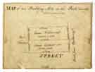 | arc03328 A map of two building lots in the Park | |
| 5 | ![A scheme for the dividing of Jonathan Tricket's croft, [1785]](https://www.picturesheffield.com/imagefiles/jpgs_sheffield2//arc03329.jpg "A scheme for the dividing of Jonathan Tricket's croft, [1785]") | arc03329 A scheme for the dividing of Jonathan Tricket's croft, [1785] | |
| 6 | 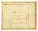 | arc03333 Plan of George Swinnerton's additional lot in the Park | |
| 7 | 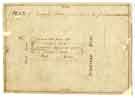 | arc03334 Plan of Jeremiah Mates second lot in the Park | |
| 8 | ![Plan of the Pond Yards with perspective drawings of mill, church, Prior Gate and houses on Potter Street, Worksop [Nottinghamshire], [late 18th cent]](https://www.picturesheffield.com/imagefiles/jpgs_sheffield3//arc03524.jpg "Plan of the Pond Yards with perspective drawings of mill, church, Prior Gate and houses on Potter Street, Worksop [Nottinghamshire], [late 18th cent]") | arc03524 Plan of the Pond Yards with perspective drawings of mill, church, Prior Gate and houses on Potter Street, Worksop [Nottinghamshire], [late 18th cent] | |
| 9 | ![A survey of the Farme called Harnis Greave in [the] parish of Worksop in the County of Nottinghame [sic] [Nottinghamshire]; belonging to [Mrs] Anne Garvis in [the] tenure and occupation of Rob[er]t Millner](https://www.picturesheffield.com/imagefiles/jpgs_sheffield3//arc03525.jpg "A survey of the Farme called Harnis Greave in [the] parish of Worksop in the County of Nottinghame [sic] [Nottinghamshire]; belonging to [Mrs] Anne Garvis in [the] tenure and occupation of Rob[er]t Millner") | arc03525 A survey of the Farme called Harnis Greave in [the] parish of Worksop in the County of Nottinghame [sic] [Nottinghamshire]; belonging to [Mrs] Anne Garvis in [the] tenure and occupation of Rob[er]t Millner | |
| 10 |  | arc04047 Broad Lane. Streets laid out in the Burgesses’ land, c. 1790 - 1806 |
Found 123694 records.