Search Results


Found 122769 records

Page of 12277.

Search Within Results

Keywords
Exclude
No Image Details Add to Album
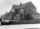
1Plumpers Hotel, at the junction of Sheffield Road and Bawtry Road, Tinsley before demolition for construction of M1 Motorway, gentleman with the stick is Mr. H. Parker of Greasbrough Roads22034

Plumpers Hotel, at the junction of Sheffield Road and Bawtry Road, Tinsley before demolition for construction of M1 Motorway, gentleman with the stick is Mr. H. Parker of Greasbrough Road

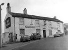
2Newmarket Hotel, No. 20 Broad Street and No. 1 Sheaf Street (1810s -1960s)s22047

Newmarket Hotel, No. 20 Broad Street and No. 1 Sheaf Street (1810s -1960s)

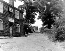
3Adelphi Hotel, No. 13 Tudor Way, (formerly No. 13 Arundel Street), at junction of Sycamore Streets22048

Adelphi Hotel, No. 13 Tudor Way, (formerly No. 13 Arundel Street), at junction of Sycamore Street

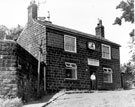
4Former Industry Inn, No. 34 Broad Street and No. 1 South Streets22054

Former Industry Inn, No. 34 Broad Street and No. 1 South Street

5Forester's Hotel, Nos. 73 - 75 Division Street, at junction of Rockingham Street. Also known as Yoricks22076

Forester's Hotel, Nos. 73 - 75 Division Street, at junction of Rockingham Street. Also known as Yorick

6Aerial view of Neepsend showing Infirmary Road, Penistone Road, River Don, Ball Street Bridge and Kelham Weir, Cornish Place Works, Cornish Works, Green Lane, Neepsend Lane (bottom), Neepsend Bridge and Neepsend Gas Workss22111

Aerial view of Neepsend showing Infirmary Road, Penistone Road, River Don, Ball Street Bridge and Kelham Weir, Cornish Place Works, Cornish Works, Green Lane, Neepsend Lane (bottom), Neepsend Bridge and Neepsend Gas Works

7Aerial view of Neepsend showing Penistone Road, Samuel Osborn and Co., Mushet Tool Works, River Don, Neepsend Lane,s22112

Aerial view of Neepsend showing Penistone Road, Samuel Osborn and Co., Mushet Tool Works, River Don, Neepsend Lane,

8Aerial view of Neepsend and Kelvin showing Kelvin Flats (top left), Royal Infirmary, Infirmary Road, site of St. Philips Church, Penistone Road, River Don and Neepsend Gas Works (right)s22113

Aerial view of Neepsend and Kelvin showing Kelvin Flats (top left), Royal Infirmary, Infirmary Road, site of St. Philips Church, Penistone Road, River Don and Neepsend Gas Works (right)

9Aerial view of Neepsend showing Royal Infirmary, Infirmary Road, site of St Philips Church, Penistone Road, River Don, Neepsend Lane Regent Works, Rutland Works and Bacon Islands22114

Aerial view of Neepsend showing Royal Infirmary, Infirmary Road, site of St Philips Church, Penistone Road, River Don, Neepsend Lane Regent Works, Rutland Works and Bacon Island

10Sheffield Swings [with] numerous discothequesy09738

Sheffield Swings [with] numerous discotheques

Found 122769 records.

Page of 12277.